Census Maps
Census maps is an interactive tool for exploring Census 2021 data across England and Wales down to a neighbourhood (or “output area”) level that I worked on with the Office for National Statistics (ONS).
I was responsible for developing the initial designs and working prototypes for the project, and for solving many of the technical and user interface (UI) challenges involved in displaying small area data for over 180,000 geographic areas in a fast, performant and intuitive way.
Among other things, I devised a quadtree data structure, which allowed the data to be served as flat files from a CDN, and for an appropriate level of geography to be displayed based on the population density in an area.
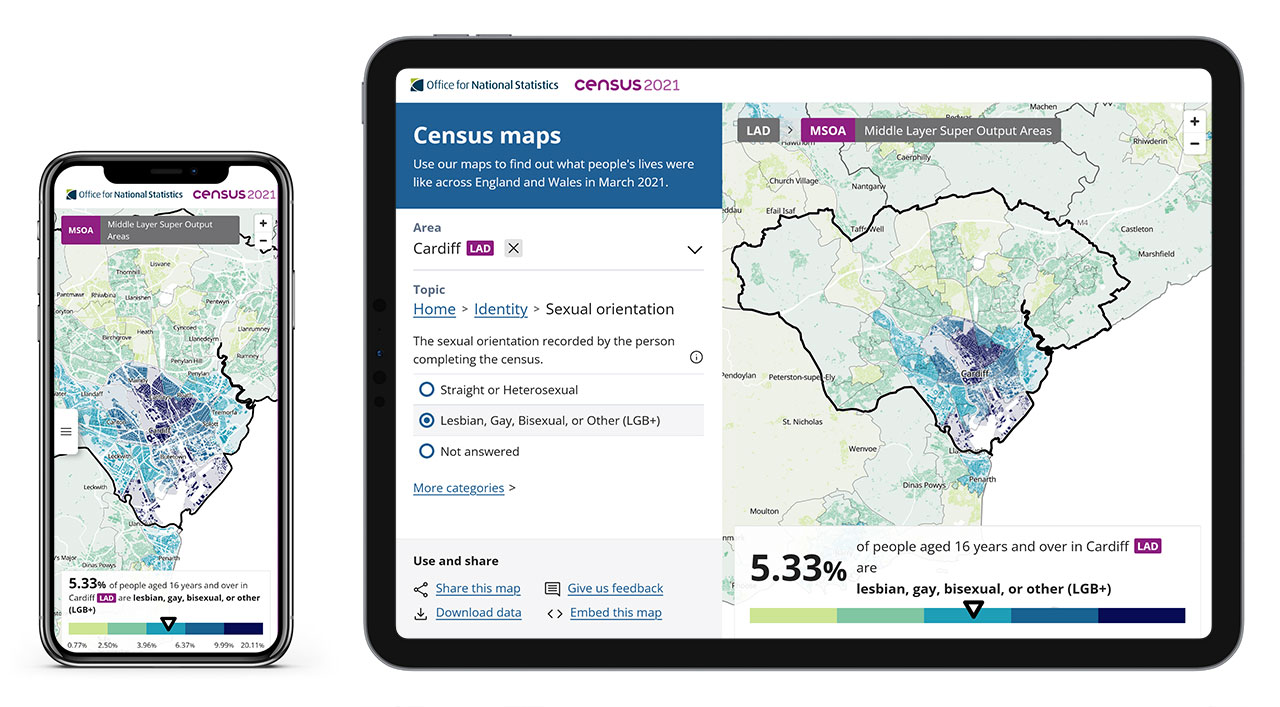
Final version of Census Maps. ONS
A demo of how the product works. Ahmad Barclay/ONS
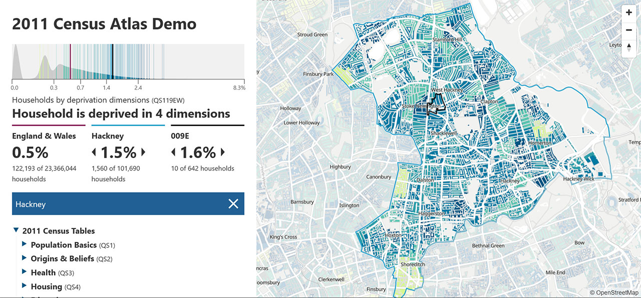
Prototype for Census Maps using 2011 census data (view). Ahmad Barclay/ONS
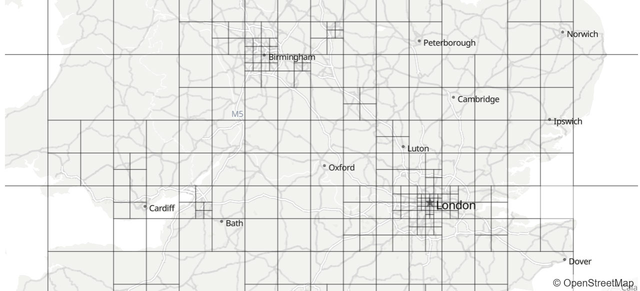
Quad-tree grid used for data loading and responsive layer switching. Ahmad Barclay/ONS

Prototype for dot density mapping (view). Ahmad Barclay/ONS

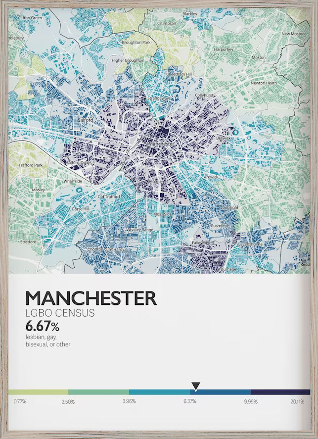
LGB+ map print designs derived from Census Maps (view). Mawgo Design/ONS